Devils Postpile National Monument

Image via Wikipedia
Devils Postpile National Monument is a U.S. National Monument located near Mammoth Mountain in Eastern California. The monument protects Devils Postpile, an unusual rock formation of columnar basalt, “all closely and perfectly fitted together like a vast mosaic. ” The monument encompasses 798 acres (323 ha) and includes two main attractions: the Devils Postpile formation and Rainbow Falls, a waterfall on the Middle Fork of the San Joaquin River. In addition, the John Muir Trail and Pacific Crest Trail merge into one trail as they pass through the monument. Excluding a small developed area containing the monument headquarters, visitor center and a campground, the National Monument lies within the borders of the Ansel Adams Wilderness.
Nearby Locations:
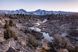
| Rainbow Falls (1.6 miles) Minaret Summit (2.5 miles) June Lake (California) (10.7 miles) Convict Lake (12.6 miles) Hot Creek (Mono County) (14.3 miles) | Brees Lookout (14.4 miles) Wild Willy's Hot Spring (17.5 miles) Cathedral Lakes (23.8 miles) Mono Lake Tufa State Natural Reserve (24.6 miles) Lundy Canyon Trail Head (29.1 miles) |
Trips Including Devils Postpile National Monument
Maps & Directions:
Get Driving Directions:
Devils Postpile National Monument, Devils Postpile Access Road
Mammoth Lakes, California 93546
This time, it's OK to leave a trace (Review)
There are no reviews yet. Be the first one to write one.
Submit a review of Devils Postpile National Monument
This article uses material from the Wikipedia article “Devils Postpile National Monument“, which is released under the Creative Commons Attribution-Share-Alike License 3.0.