From Vegas to Tahoe - Route 395 Is the Ultimate California Road Trip
Locations Visited:
You need to take a California road trip on Route 395.
Tourists know about the Pacific Coast Highway road trip, and sure, that’s a spectacular oceanside drive. The California road less traveled and more spectacular, however, actually starts in the desert, bypasses several National Parks, and swings past Lake Tahoe.
A Route 395 California road trip will take you from below sea level to the highest mountain top in America all in one drive. The entire distance of U.S. Route 395 runs from Hesperia, California (at Interstate 15) to the Canadian border in Laurier, Washington, but for the purposes of this trip, we’re going focus on the California stretch of Route 395.
There’s so many places to go on a Route 395 California road trip, you’d probably need a month to do it justice. But we’ve captured some of the best locations you’ll want to visit along the way. We’ve also added in a few awesome stops to get you from Las Vegas to Route 395, mostly because we love Vegas. Besides, if you’re going to be in the area, there’s a few destinations worth seeing at the beginning of your trip that aren’t actually on Route 395.
We’ve done this Route 395 California road trip a few times, and most recently we started in Las Vegas, turned around after a few days in Lake Tahoe and retraced our drive back to Vegas. We still haven’t seen everything. But we did cover quite a bit of ground along Route 395 and beyond.
Leaving Las Vegas, Don’t Miss Red Rock Canyon
Tourists flock to Las Vegas, Nevada for gambling, night life, pool parties and entertainment, but it also might be the best road trip starting point in America.
While Sin City’s immediate perimeter is surrounded by a desert, that doesn’t mean there’s nothing to see. Just about 25 minutes west of the Las Vegas Strip is Red Rock Canyon, which is a beautiful hiking destination year-round. Red Rock Canyon has become iconic and increasingly popular among the locals, especially on weekends and holidays.
Even if you’re not into hiking, the 13-miles scenic loop is a must-see with several pull-off points suitable for photo opportunities with red sandstone backdrops, as well as an impressive view of the Las Vegas valley. Just beware of small wildlife and cyclists along the road. A Red Rock Canyon day pass is $15 for vehicles, and annual passes are available.
Need even more hiking options? Check out nearby Calico Basin, which is next door to Red Rock Canyon, but not nearly as popular.
Turn Back Time in Beatty and Rhyolite
About two hours northwest from Red Rock Canyon sits Beatty, Nevada, which was once a gold rush hub, but today plays host to only about 1,000 permanent residents. Whether its kitsch or history you love, Beatty has a little something for everyone.
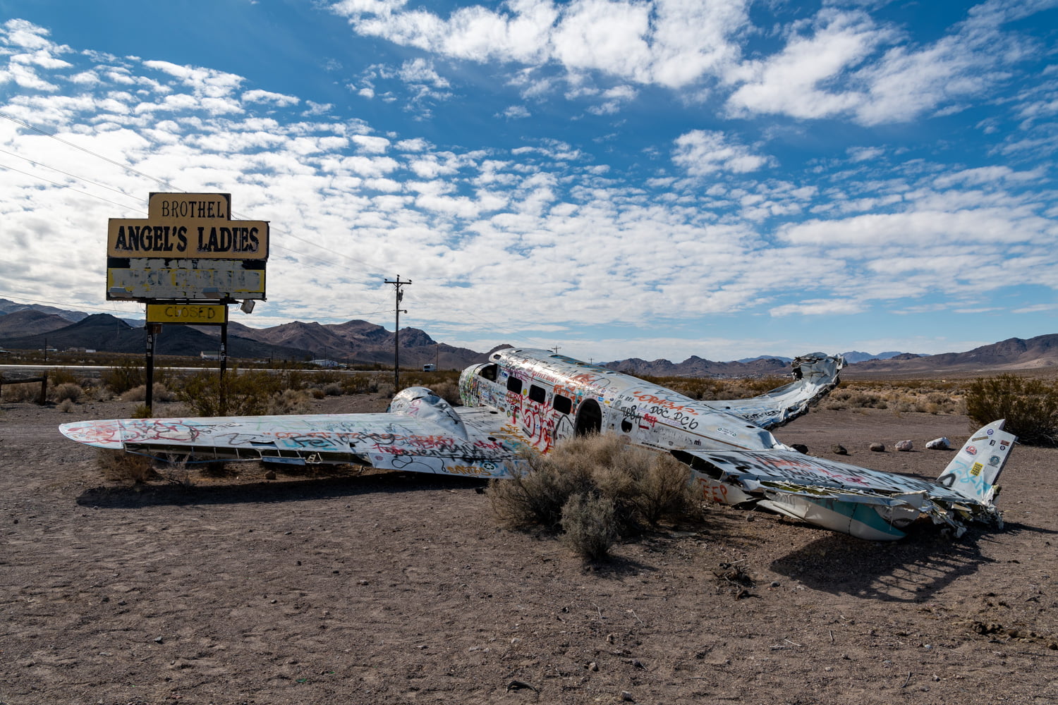
Angel’s Ladies, abandoned brothel in Beatty, NV on February 21, 2020. Photo by Peter Stringer
As you head up Route 95, it’s worth initially bypassing Beatty to check out Angel’s Ladies, an abandoned brothel that features a roadside plane crash. The sun-baked roadside wreckage remains from a decades-old marketing stunt gone bad.
As the story goes, a mattress sat in the center of a large star painted on desert ground, and anyone who could successfully parachute out of the airplane and stick the landing on the makeshift bed would win a free night at the establishment.
This promotion led to a crash of the twin-engine D-18 in 1978, and the downed bird and yellow sign have since earned unofficial landmark status. The brothel, however, has been closed since 2014. It’s a fun look at Nevada’s recent past, but there’s more ancient history awaiting just south of town down Route 374.
The ruins of Rhyolite ghost town date back to over 100 years ago, and there’s a few structures still standing where a bustling gold-rush town once stood. Rhyolite had a very short zenith, basically from 1905-1910.

Lady Desert – The Venus of Nevada in Beatty, NV on February 21, 2020. Photo by Peter Stringer
Nearby, Beatty’s quirky and random attractions, including the Goldwell Open Air Museum, Tom Kelly’s Bottle House, The Last Supper and Lady Desert the Venus of Nevada are all worth a visit.
These spots make Beatty and Rhyolite a must-stop and a fun way to spend an afternoon.
Death Valley National Park is Alive!
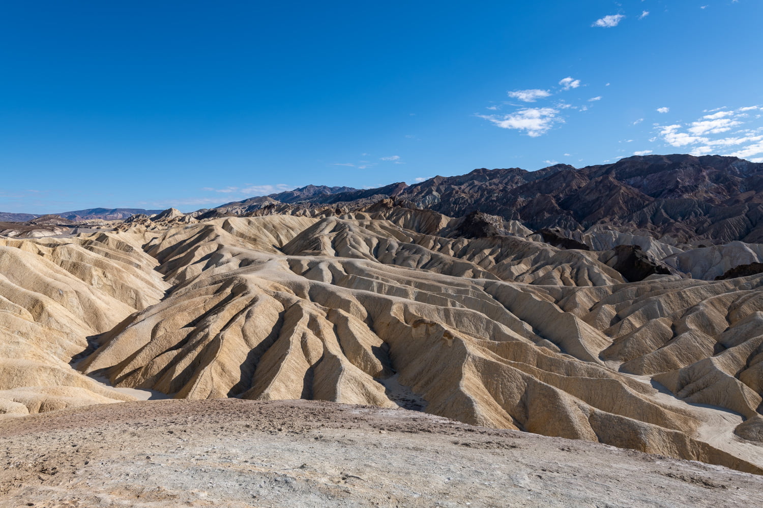
Zabriskie Point, Death Valley National Park on February 21, 2020. Photo by Peter Stringer
Everyone’s heard of Death Valley, but they probably don’t know much about it beyond that it gets really hot. Seated along the western border of southern Nevada, Death Valley National Park has an edge of the Earth feeling to it, presenting an unexpected diversity of colorful landscapes.
Oh yeah, and Death Valley National Park does get really, really hot. On August 16, 2020, a 130-degree temperature was recorded at the aptly-named Furnace Creek, ranking as the hottest temperature ever recorded on Earth. Claims of a 134-degree day in 1913 have been disputed by scientists, but the previous high of 129 degrees was hit in 2013.
The park also goes to extremes when you consider its size. Measured by footprint, only four U.S. National Parks are larger than Death Valley National Park, and they’re all in Alaska. Getting around Death Valley’s 5,300+ square miles requires a lot of driving, and the highlights of the park are scattered throughout. You ‘d have to start at the crack of dawn to hit all there is to see in one day.
In the southern portion of the park, Zabriskie Point and Artist’s Palette are must-see stops, and a photographer’s dream. Badwater Basin, a salt-covered basin seated 282 feet below sea level, is the lowest land point in North America.
You’ll have to head back north on CA-190 to continue to make tracks toward Route 395, but on your way, Mesquite Flat Sand Dunes is a very popular attraction. The dunes are a 100-foot pile of sand in a basin set against a backdrop of purple mountains and usually, severe blue skies. The dunes have been featured in countless Hollywood productions thanks to Death Valley National Park’s proximity to Los Angeles, as well as its outer-space vibes.

Mesquite Flat Sand Dunes at Death Valley National Park on February 25, 2020. Photo by Peter Stringer
Sunsets at Mesquite Flat Sand Dunes are among the best in North America, so it’s worth planning to be there from magic hour through twilight.
If you’ve got time for a hike, Mosaic Canyon is among the most popular of trails, especially from October to April when temperatures are far more moderate. On your way out of the park, after a white-knuckle drive around some winding roads fit for a car commercial, stop in at Father Crowley’s Overlook to take in another breathtaking vista.
When Irish rock band U2 was visiting the United States in December 1986 ahead of releasing their hit album, The Joshua Tree, they visited Death Valley and ended up taking pictures with Anton Corbijn off the side of the road just outside the park. Years later, superfans of the band eventually figured out the iconic tree’s location. U2’s Joshua Tree is not in Joshua Tree National Park, but’s actually off the west side of CA-190 near Darwin, California, just west of Death Valley National Park.
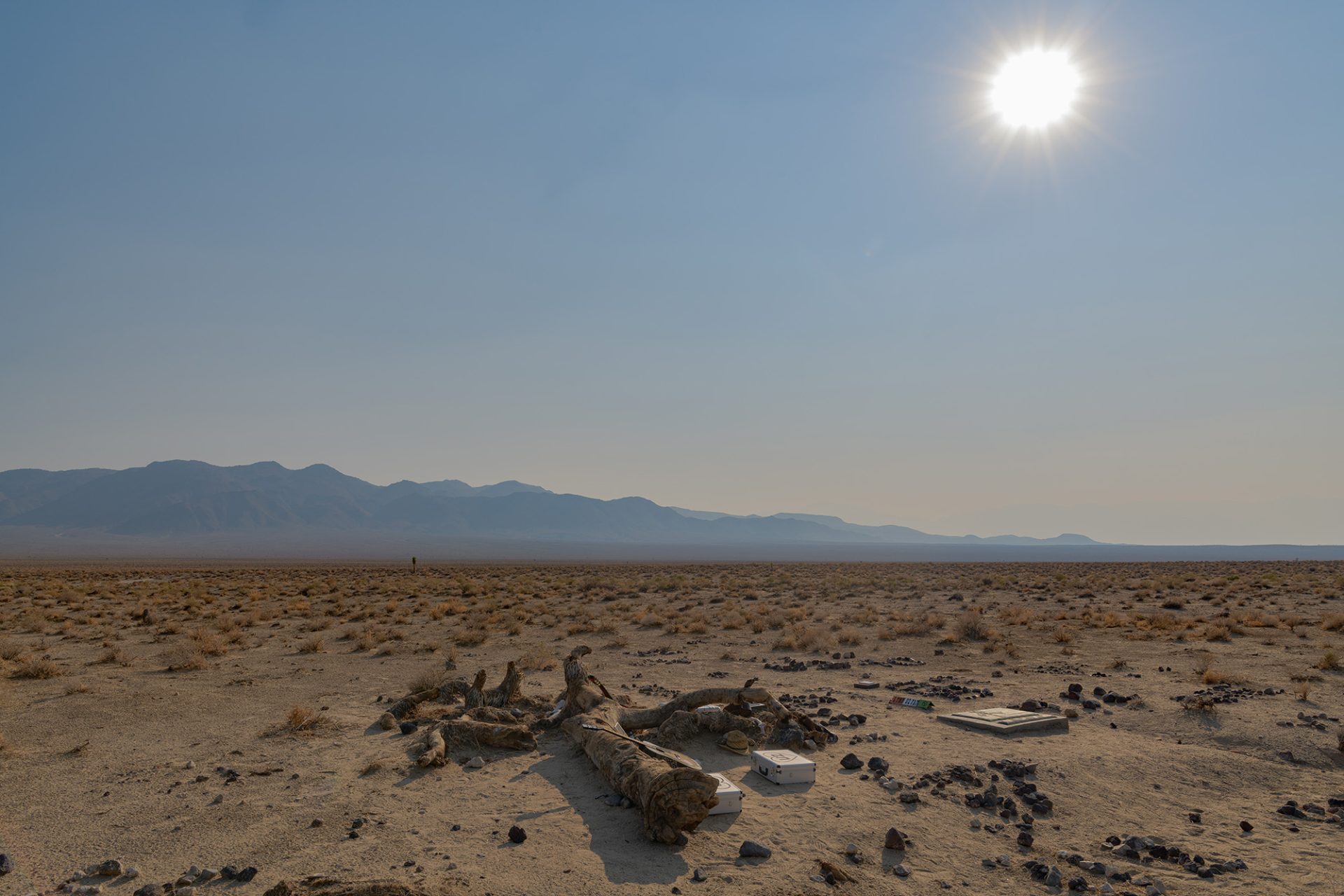
Monument to the fallen Joshua Tree from U2’s famed album cover / Darwin, CA
Decades after the photo shoot, the tree no longer stands, lying in a heap the sand. U2 enthusiasts have turned the site into a shrine of sorts to Bono and the boys, leaving Irish flags, notebooks, guitars and other memorabilia with the fallen tree, as well as a small bronze plaque that’s installed on the desert floor.
On to 395 and Lone Pine
At this point, the main event begins as you’ll follow CA-190 to the junction of CA-136. Owens Lake Plaza is out the driver’s side window, where there’s a wildlife refuge and hiking trails, and if you do pull in, you’ll probably be the only person there. The lake is mostly dry these days, the roads to the plaza are dirt and berm and sort of marked (use caution), but the plaza is unique. Is it worth a stop? That’s up to you. We’d recommend pressing north toward Lone Pine, where you’ll finally meet up with Route 395.
We could have just started this road trip story here in Lone Pine, but we figured it made more sense to start you in Las Vegas and take you through the desert first.
Lone Pine, California sits just about 25 miles east of Sequoia National Park. A quick look at a map might suggest that Sequoia would be on the itinerary, however, you can’t access it from Lone Pine. To reach Sequoia, you’ll need to double back around the southern base of the mountains and approach from the west, as Mount Whitney blocks a potential entrance from the east. The drive is well over four hours, so we’d suggest saving Sequoia and Kings Canyon National Park for your next Interstate 5 Road Trip.
You can, however, access Whitney Portal and Lone Pine Lake from Lone Pine. Hiking Mount Whitney is not for the inexperienced; at over 14,000 feet, Mount Whitney is the highest peak in the lower 48 states. You need a permit to do the hike, and you’ll need to train for this 20-mile hike.
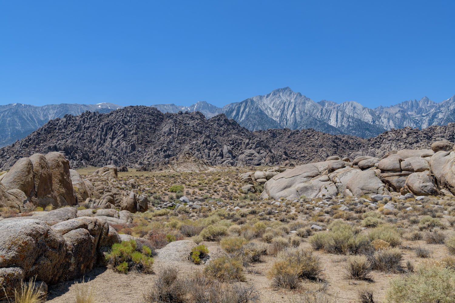
The Alabama Hills in Lone Pine, California on August 12, 2019. Photo by Peter Stringer
Lone Pine is rife with motion picture history as the Alabama Hills have served as a location for movies for years, starting with early westerns featuring Gene Autry, Hopalong Cassidy, and John Wayne. More recently, modern movies like Tremors, Gladiator, Iron Man and Django Unchained were filmed here. The Lone Pine Film Festival happens here every October, celebrating the region’s rich cinematic history.
Moving north along 395, you’ll pass through Independence and Big Pine en route to Bishop, California. Bishop is known for multiple hot springs and the Ancient Bristlecone Pine Forest. If you’re into rock climbing, the nearby Buttermilk Boulders are a hot spot; they’re known for some of the toughest bouldering available in California.
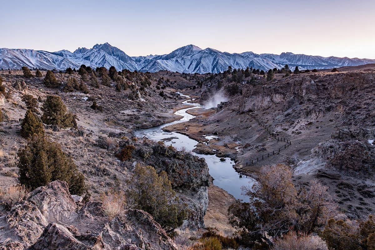
Mammoth Lakes Is a Destination Year Round
After Bishop, U.S. Route 395 veers off to the Northwest, and about 45 minutes up the road you’ll find Mammoth Lakes, California. Similar to Lone Pine, Mammoth Lakes has a multitude of attractions and plenty of altitude. Known primarily as a snowboarding and skiing resort town, Mammoth Lakes sits at nearly 8,000 feet above sea level on a hotbed of thermal activity, and as such, offers some incredible natural features. Mammoth Lakes is known for snowy winters and dry summers, and as such, what’s available to see and do depends largely upon what time of year you visit.

Minaret Vista in Mammoth Lakes, California on August 12, 2019. Photo by Peter Stringer
Attractions like Devils Postpone National Monument, Rainbow Falls and Minaret Vista may be unreachable in the winter months thanks to road closures. But there’s one can’t miss location in Mammoth Lakes. Among the most enchanting spots in California is Hot Creek Geological Site, where you can walk an interpretive trail along the thermal river of geysers. For photographers, Brees Lookout is among the most spectacular photo locations in the region. Bring your telephoto zoom lens to get the art gallery money shot with a compressed backdrop of Laurel Mountain towering over the thermal creek at sunset.
Brees Lookout at Hot Creek in Mammoth Lakes, CA on February 23, 2020. Photo by Peter Stringer
You’ve probably seen Instagram photos from the Lake Crowley stone columns, however, to get there you’ll need a high clearance 4×4 to traverse a long, winding and unmaintained mountain dirt road. There’s also plenty of hot spring locations in the area.
When it comes to more accessible yet highly picturesque lake settings, Tom’s Place and Convict Lake are two of the most popular spots in Mammoth Lakes. Convict Lake offers turquoise waters, an incredible mountain backdrop, water sports and camping. We stopped Convict Lake at 1 AM for some astrophotography and got some pretty awesome results thanks to the sky’s reflection in still waters below the mountains.
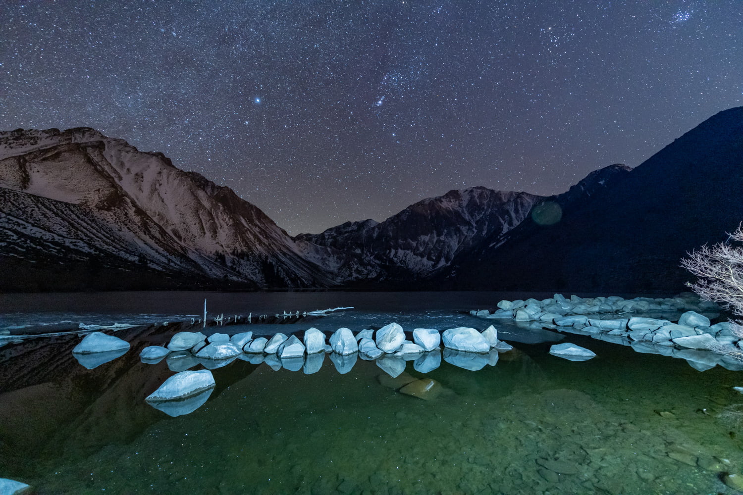
Convict Lake at Night on February 24, 2020. Photo by Peter Stringer
As you trek further north through Mono County and leave Mammoth Lakes in your rearview, you’ll encounter more popular lakes. There’s a scenic loop at June Lake worth checking out, and as you reach Lee Vining, California, you’ll see the massive Mono Lake off to the east. Mono Lake covers over 65 square miles and is believed to be over one million years old. Locals believe the ancient saline lake holds medicinal powers in its dense, salty waters.
For some unique visuals, stop in at Mono Lake Tufa Natural Reserve, where you can take a nature hike through a bird habitat to the water’s edge and admire the limestone spires called tufa towers. This is another must-see for shutter bugs.

Mono Lake Vista Point on Route 395 in Lee Vining, CA on February 23, 2020. Photo by Peter Stringer
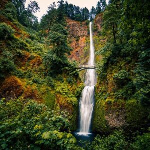
If you can’t see Yosemite, a hike through Lundy Canyon is much easier to access off Route 395. You’ll follow a riverside trail past waterfalls that will give you a taste of things to come when you visit the big park.
The Home Stretch to Lake Tahoe
The drive from Mono Lake to Lake Tahoe is about 2 hours, and while it’s scenic, there aren’t nearly as many stopping points along the way. You’ll pass Topaz Lake at the California-Nevada border, which has a nice recreation area on the lake’s east side. As you approach Tahoe, you’ll have plenty of options for a route to the lake, the only question is, which side of the Lake to hit? There’s plenty to see in both California and Nevada.
On the California side, Emerald Bay State Park on the south side of the Lake is a must-see. On the Nevada side, Sand Harbor is an easy beach to access, and there are plenty of scenic beach locations along Route 28, including Emerald Cove and Hidden Beach. Lake Tahoe Nevada State Park is also the biggest park on the shores of the lake.

Emerald Bay State Park in South Lake Tahoe, California on February 23, 2020. Photo by Peter Stringer
There are more comprehensive guides to Lake Tahoe to be found; this piece is more about the journey than the destination, if you will. The region has options for hiking, camping, skiing, cruises and other outdoor activities, as well as restaurants, nightlife and casinos in the South Lake Tahoe area.
This Las Vegas to Lake Tahoe itinerary is chock-full of ideas stops from start to finish. You don’t need to stop everywhere to have an incredible trip.
But hey, you’ve got plenty of options.
This time, it's OK to leave a trace (Review)
Thank you!
I’m doing this route this week to avoid 95 to Reno. Thank you for posting such a detailed description!