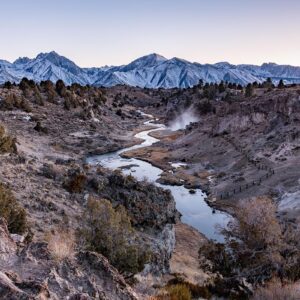
White Pocket

White Pocket in Arizona on November 28, 2018. Photo by Peter Stringer
Geological Wonders
The mesmerizing formations of White Pocket are primarily composed of Navajo Sandstone, shaped by millions of years of sediment deposition, tectonic activity, and erosion. What sets White Pocket apart from nearby geological wonders, such as The Wave in the Coyote Buttes, is its chaotic and complex patterns. The landscape features an array of vibrant hues — from soft whites and pinks to deep reds and oranges — that twist and ripple across the rock surfaces. These undulating patterns are believed to have formed due to ancient sand dunes that, over time, were compacted and lithified into stone. Iron oxide and other mineral deposits further contributed to the dramatic color contrasts.
Getting to White Pocket
Accessing White Pocket requires careful planning and preparation. Situated about 30 miles from the small town of Kanab, Utah, the journey involves navigating unpaved roads, deep sand, and rugged terrain. A high-clearance, four-wheel-drive vehicle is essential, and travelers are advised to carry ample water, food, and emergency supplies. Due to the rough conditions, many opt to join guided tours offered by local outfitters who provide both transportation and expert knowledge about the area’s geology, history, and ecology.
Photography and Exploration
White Pocket is a dream destination for photographers. The soft, diffused light of sunrise and sunset enhances the already vibrant colors, casting dramatic shadows and highlighting the swirling patterns of the sandstone. Long-exposure photography can capture the vivid interplay of light and shadow, while macro photography reveals the intricate details of the rock textures.
Exploring White Pocket is an unstructured experience, as there are no designated trails. Visitors are free to wander and discover the formations at their own pace. Some of the most iconic features include the “brain rock,” characterized by its bumpy, brain-like surface, and the “cauliflower” formations, where rocks resemble the curdled surface of the vegetable. Hidden pockets of water, known as tinajas, sometimes form after rainfall, creating ephemeral pools that reflect the vibrant rocks and add another layer of beauty to the scene.
Flora and Fauna
Though the landscape appears barren at first glance, White Pocket supports a surprising variety of plant and animal life adapted to the harsh desert environment. Desert-adapted plants like yucca, Mormon tea, and various species of cacti cling to the rocky crevices, while small shrubs dot the sandy patches. Wildlife such as jackrabbits, lizards, and coyotes can occasionally be spotted, along with a diverse array of birds, including ravens, hawks, and the occasional golden eagle soaring overhead.
Cultural and Historical Significance
White Pocket is also part of a region rich in Native American history. The area was traditionally inhabited by the Southern Paiute, Navajo, and Ancestral Puebloan peoples, who left behind traces of their presence in the form of petroglyphs, ancient tools, and pottery fragments. While White Pocket itself has fewer archaeological artifacts compared to nearby sites like the Paria Plateau, its cultural significance remains tied to the larger history of the Colorado Plateau and the Indigenous communities that once thrived there.
Conservation and Responsible Tourism
As White Pocket gains popularity, conservation efforts become increasingly important to protect its fragile ecosystem and geological wonders. Visitors are encouraged to follow Leave No Trace principles, which include packing out all trash, avoiding stepping on delicate rock formations, and respecting the natural and cultural heritage of the area. Staying on durable surfaces and minimizing human impact helps ensure that future generations can also experience the untouched beauty of White Pocket.
Conclusion
White Pocket stands as a hidden gem within Arizona’s vast desert landscape — a place where nature’s artistry is on full display. Its swirling sandstone formations, vibrant colors, and remote serenity offer a unique escape for those willing to brave the journey. Whether you’re a photographer capturing its surreal beauty, a hiker marveling at the geological wonders, or a traveler seeking solitude and inspiration, White Pocket promises an unforgettable experience. As more people discover this remote paradise, it is crucial to balance exploration with preservation, ensuring that White Pocket’s magic endures for years to come.
White Pocket might be the most unique landscape in America. It’s certainly one of the most remote locations you’ll find along the Arizona/Utah border. It’s not easy to get to White Pocket; you’ll definitely need a high-clearance 4×4, and you’ll need to be prepared for changing road and weather conditions. The drive in is about 90 minutes off of US-89.
It’s advisable to stop at the Kanab Visitor’s center on the day of your trip to inquire about road conditions before attempting the trip; if it’s rained in the past 24-48 hours, the roads may not be passable. We’d recommend hiring a local tour company that has experienced guides who can get you in and out of White Pocket safely. If you’re a photographer, Action Photo Tours offers spectacular photo tours of White Pocket that are incredible values.
That said, once you do get to White Pocket, you’ll be rewarded with some of the most unique and scenic sandstone formations you can see on the entire planet. White Pocket is a photographer’s paradise, where almost every color of the rainbow can be found in the landscape during a sunrise or sunset. There is no set trail after the parking lot, cell service is spotty at best, and you could easily get lost so a GPS unit is also advisable.
While White Pocket is still relatively under the radar, it’s gained more notoriety in recent years. But because of the difficulty and preparation required to reach White Pocket, you’re likely to be among only a few people when you do arrive.
Nearby Locations:
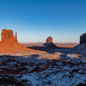
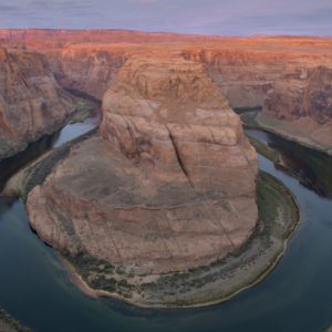
| Buckskin Gulch (3.8 miles) Coyote Buttes (6 miles) Toadstool Hoodoos (10.7 miles) Stud Horse Point (16.8 miles) Vermilion Cliffs National Monument (17.3 miles) | Yellow Rock (20.9 miles) Waterholes Canyon (22.3 miles) Horseshoe Bend (22.4 miles) Lake Powell (23.2 miles) Cathedral Canyon (26.1 miles) |
Maps & Directions:
Get Driving Directions:
White Pocket, Arizona 86036
Visit the White Pocket Website
This time, it's OK to leave a trace (Review)
There are no reviews yet. Be the first one to write one.