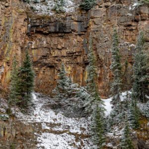
Ramona Falls Trailhead
You’ll feel like you stepped into a fairytale when you reach Ramona Falls. You’ll arrive at the falls about four miles into the hike after crossing the Sandy River. There is no bridge, so be mindful that the Sandy River can be treacherous to cross—especially when the river swells later in the day or after significant rainfall.
Other than the river crossing, the trail isn’t difficult and the landscape transforms as you approach Ramona Creek. Ramona Falls pours over a wall of natural basalt stairs and widens before it enters the pool below. There are a few shady and cool picnic spots near the falls, too.
Nearby Locations:
| Mt. Hood (6.6 miles) Lost Lake (Oregon) (7.6 miles) Tamanawas Falls (12.6 miles) Wahclella Falls (17.8 miles) Horsetail Falls (18.1 miles) | Multnomah Falls (19 miles) Bridge of the Gods (19.3 miles) Dog Mountain (22.4 miles) Wind Mountain Trailhead (22.9 miles) Dougan Falls (25.1 miles) |
Lists & Guides Including Ramona Falls Trailhead
Maps & Directions:
Get Driving Directions:
Ramona Falls Trailhead, Muddy Fork Rd
Rhododendron, Oregon 97049
Visit the Ramona Falls Trailhead Website
This time, it's OK to leave a trace (Review)
There are no reviews yet. Be the first one to write one.


